New York State Historic Markers and Monuments, Town of Chemung and Surrounding Areas
Don't miss any .....scroll all the way to the bottom of the page!
A few of the markers from Lowman have been added to the page at the end.
A few of the markers from Lowman have been added to the page at the end.
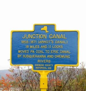
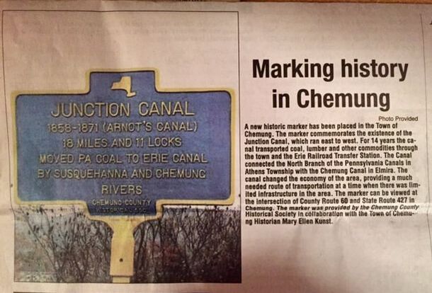
Junction Canal, Corners of Rt. 427 and County Rt. 60, Chemung, NY (Chemung County Historical Society Marker)
GPS 42.009096,-76.626358
GPS# 42.009096,-76.626358
|
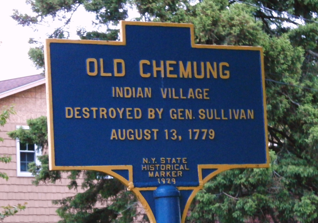
New York State Historic Marker. Old Chemung Indian Village, Located on Main Street, County Route 60, Chemung, NY
GPS42.008962,-76.625110
GPS# 42.008962,-76.625110
|
(This marker was recently reinstalled. It originally sat at the Chemung Roadside Rest on Route 17. When the highway was improved to I-86 the roadside rest was closed and the sign was stored at the NYSDOT in Horseheads until recently. As you can see, it needs a new paint job.
I've heard through the grapevine that the sign will be touched up and I look forward to that!
I'll be sure to post an updated photo when it's done.)
I've heard through the grapevine that the sign will be touched up and I look forward to that!
I'll be sure to post an updated photo when it's done.)
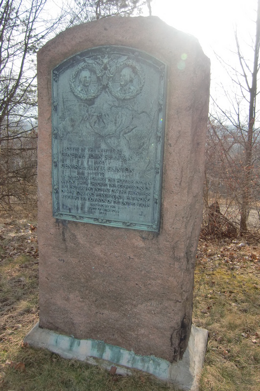
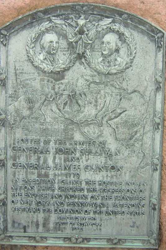
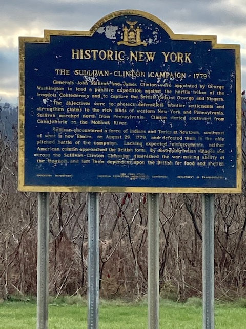
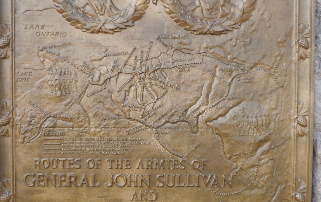
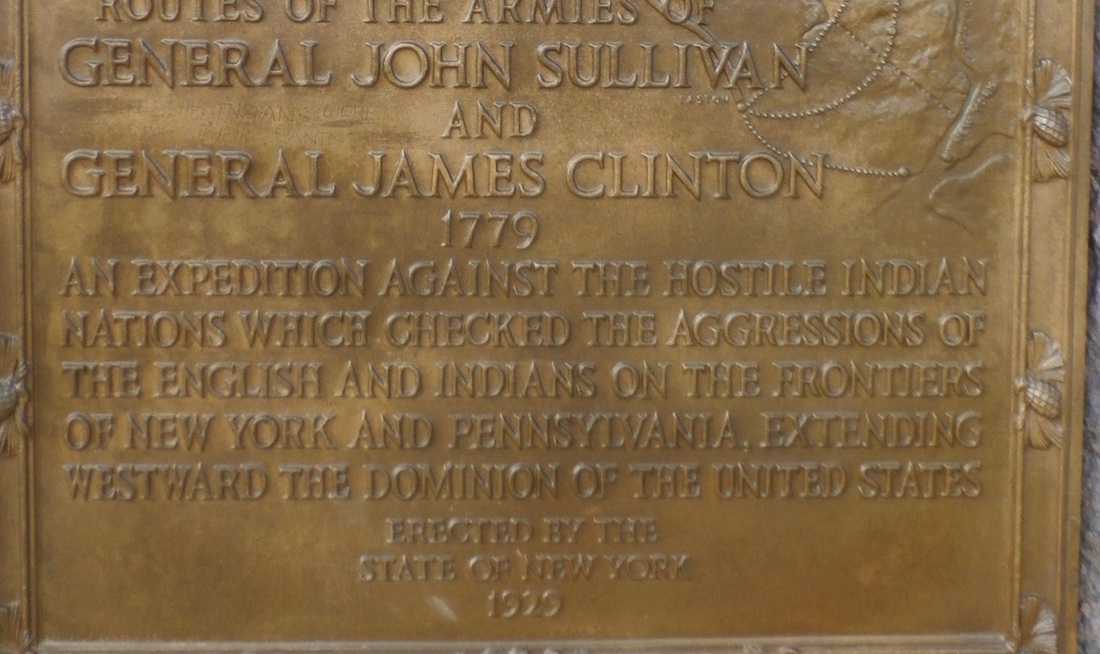
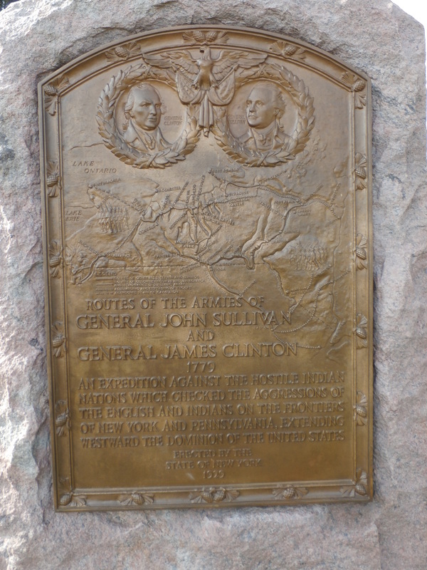
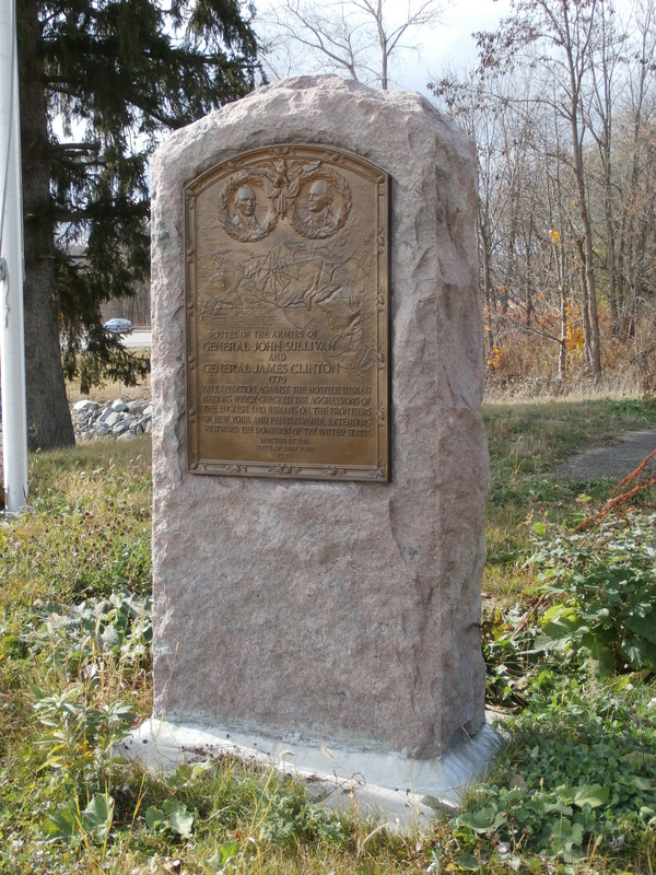
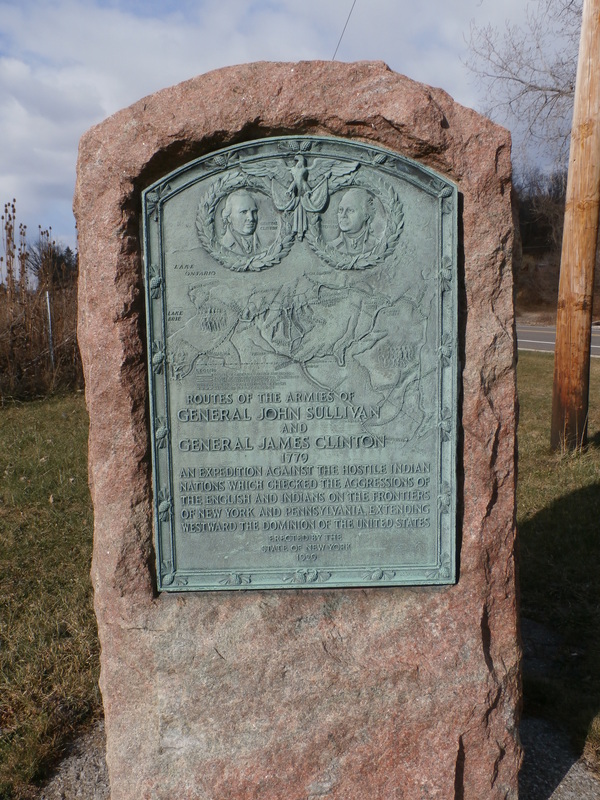
Historic New York, The Sullivan-Clinton Campaign 1779 - Corners of State Rt. 427 and County Rt. 60, Chemung, NY (New York State Historical Marker)
GPS 42.009096,-76.626358
GPS 42.009096,-76.626358
New York State Historic Markers located in the Town of Chemung, New York

Sullivan Road Historic Marker, NYS Historic Marker, (intersection of County Rt. 60 & Lyons Rd, west of the village), Town of Chemung, NY GPS# 42.011727,-76.629290
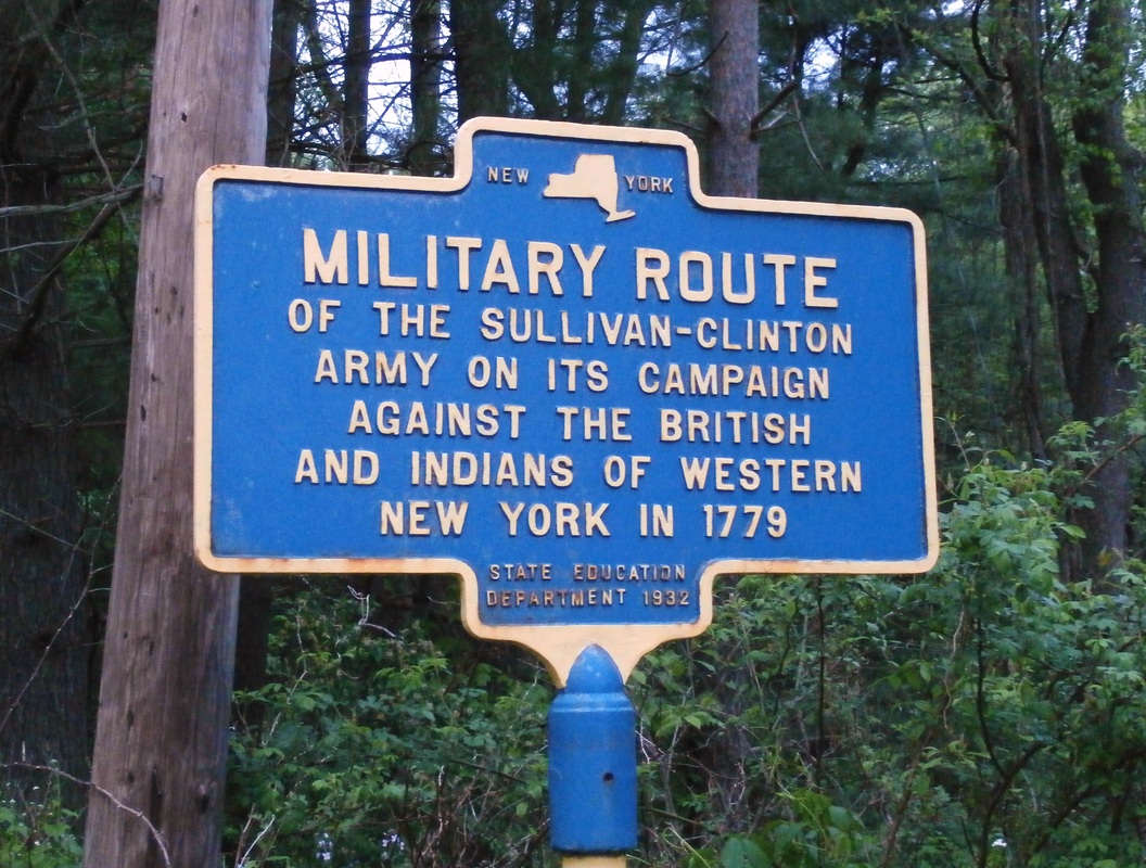
Military Route Historic Marker, NYS Historic Marker, East Main Street, County Route 60, Town of Chemung, NY GPS# 42.007326,-76.608291
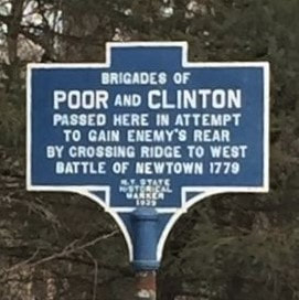
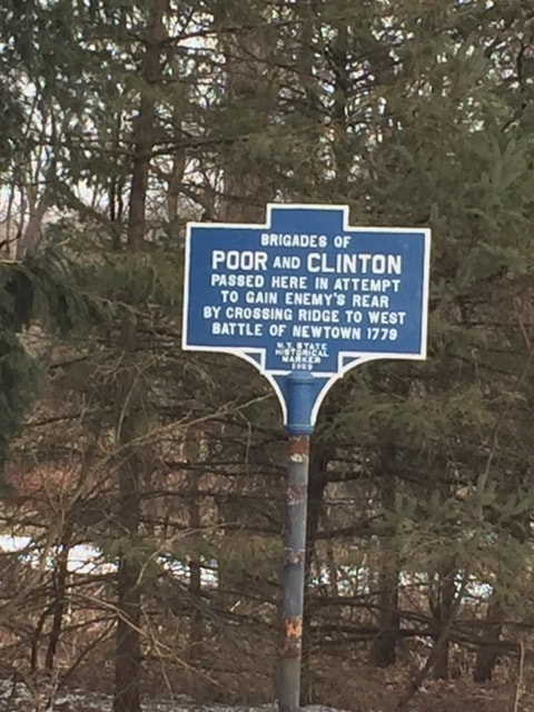
Brigades of Poor and Clinton, NYS Historic Marker, Lowman Road, Town of Chemung, NY GPS# 42.041078,-76.719279
Military Route Historic Marker, NYS Historic Marker, East Main Street, County Route 60, Town of Chemung, NY GPS# 42.007326,-76.608291
Brigades of Poor and Clinton, NYS Historic Marker, Lowman Road, Town of Chemung, NY GPS# 42.041078,-76.719279
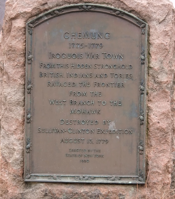
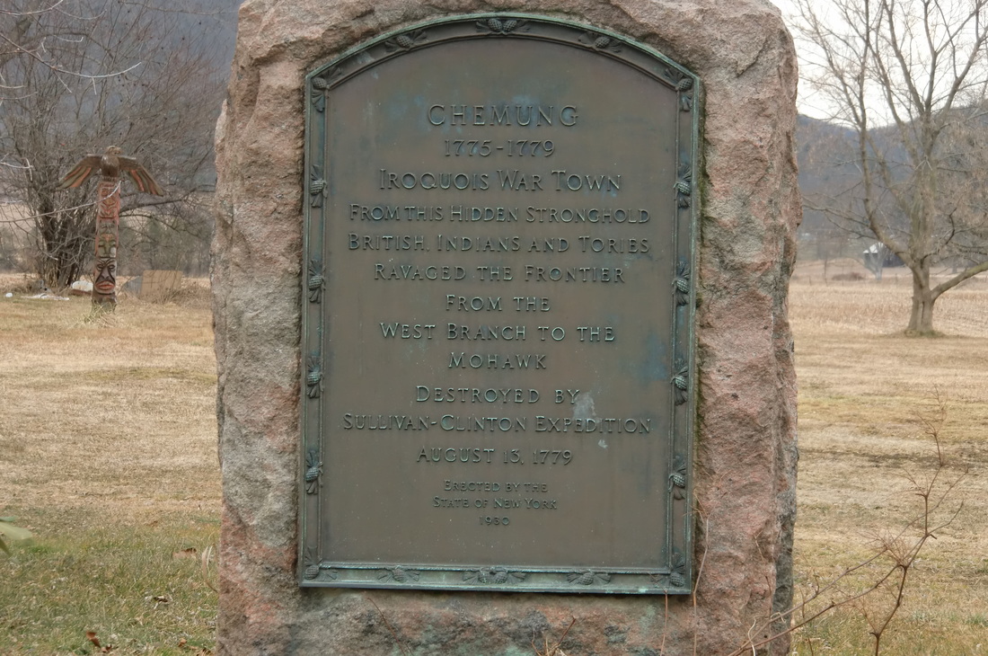
Iroquois War Town, NYS Historic Marker located on County Rt 60, west of the town, Chemung, NY GPS# 42.028050,-76.663094

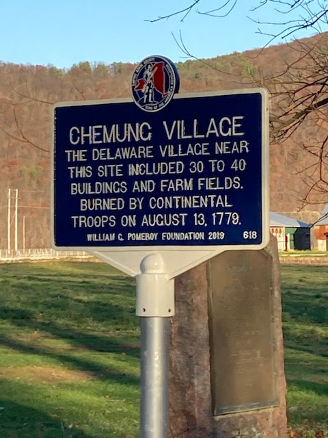
Chemung Village,
Located on Co Rt 60,
Chemung, NY
42.02728, -76.662816
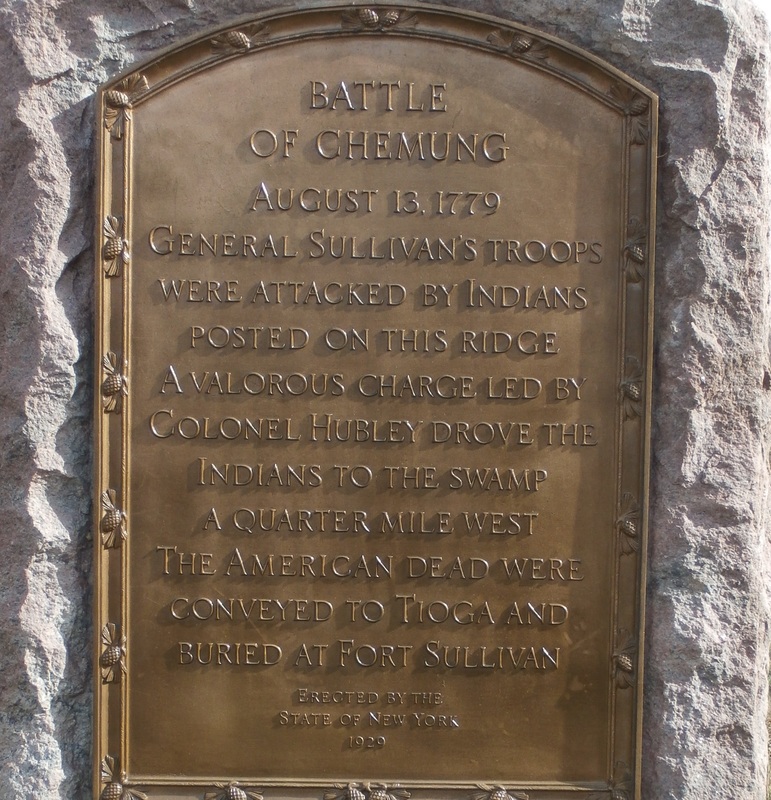
Battle of Chemung 1779, NYS Historic Marker located on County Route 60, west of the town, Chemung, NY GPS# 42.028081,-76.687933

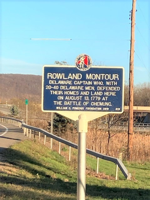
Rowland Montour, Located on Co. Rt 60, Chemung, NY 42.027957, -76.68785
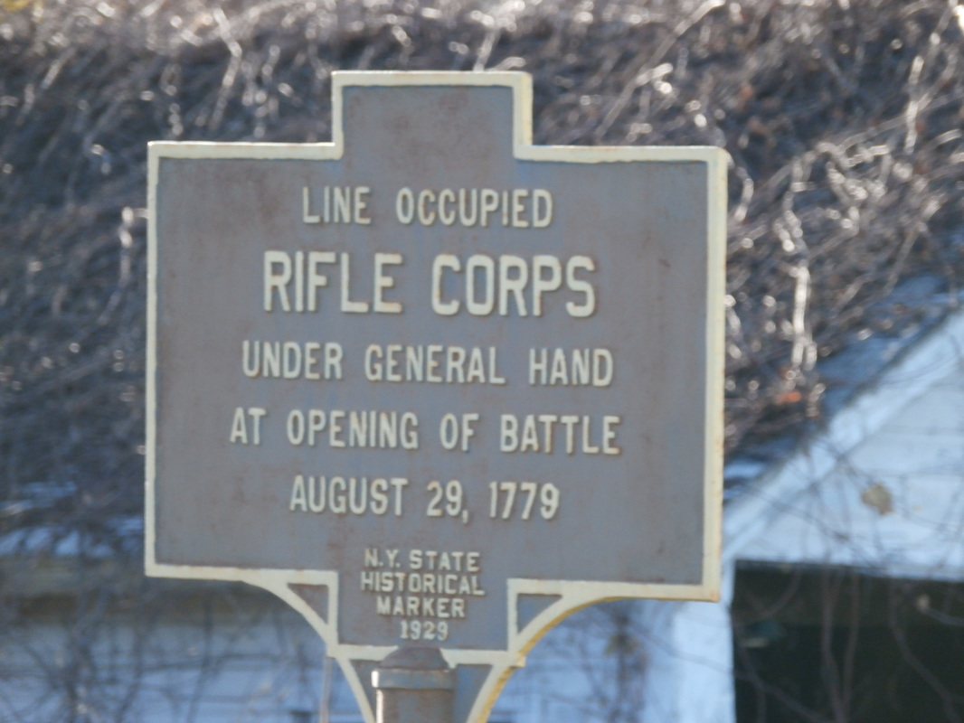
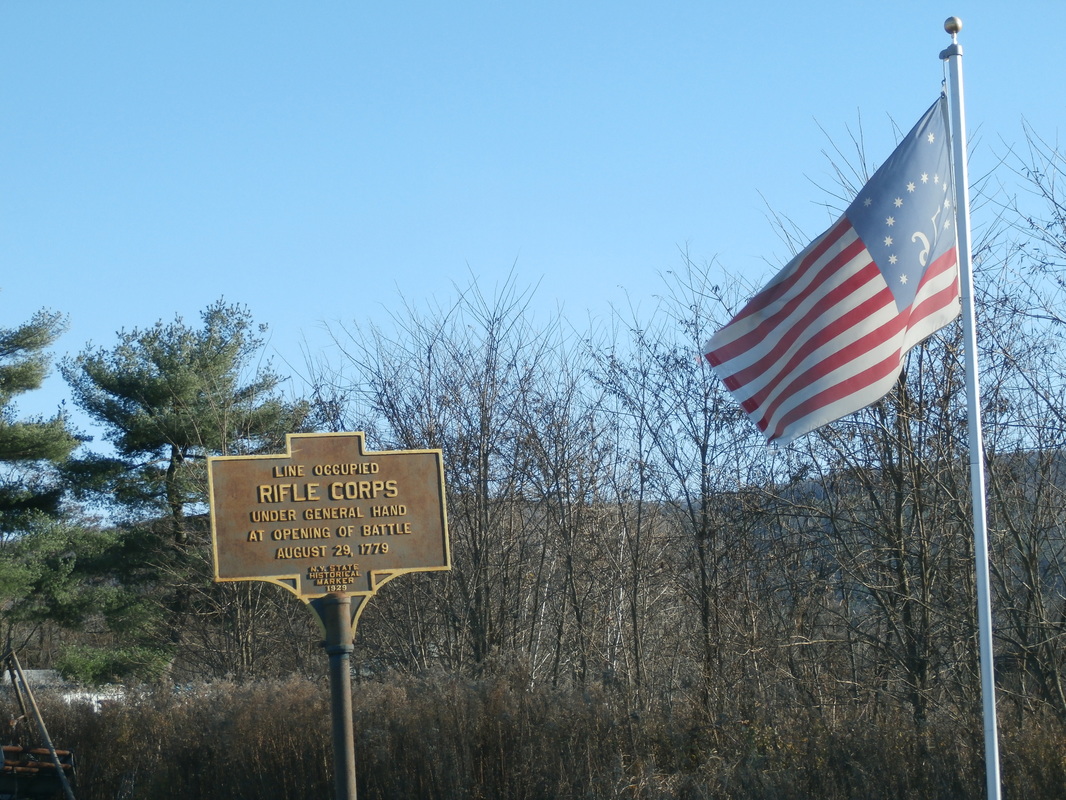
Line Occupied Rifle Corps, NYS Historic Marker, located on County Route 60, west of the town, Chemung, New York GPS #42.029311,-76.717194
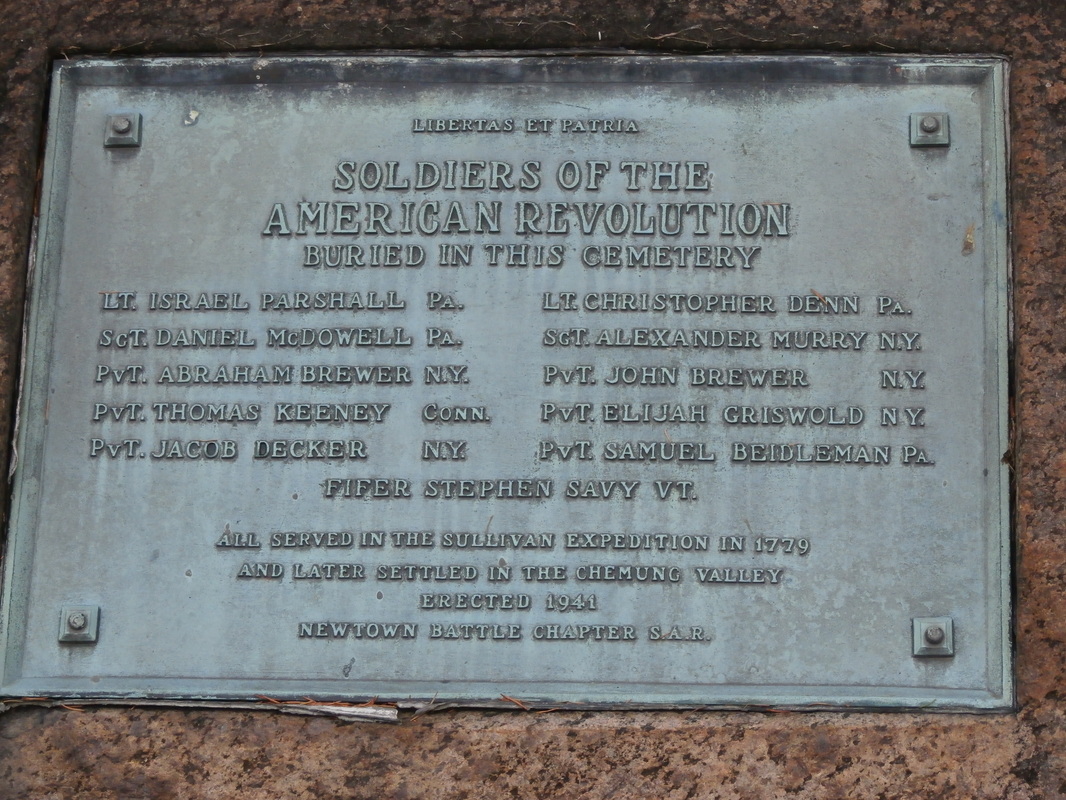
Soldiers of the American Revolution buried in this Cemetery, Newtown Battle Chapter S.A.R. located at Riverside Cemetery, County Route 60, west of the town, Chemung, New York. GPS#42.029330,-76.675856
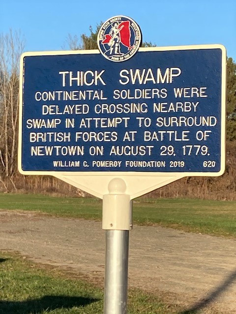
Thick Swamp, Located on Co. Rt. 60 across from Fountain Rd., Chemung, NY 42.028475, -76.715791
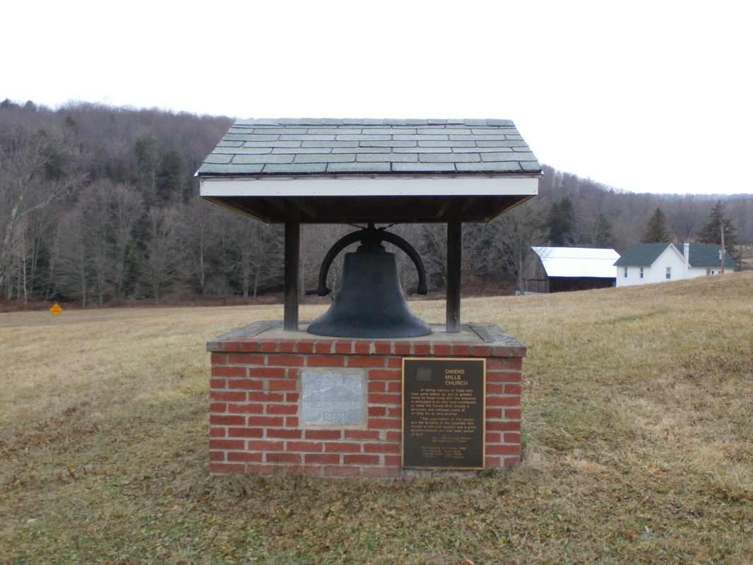
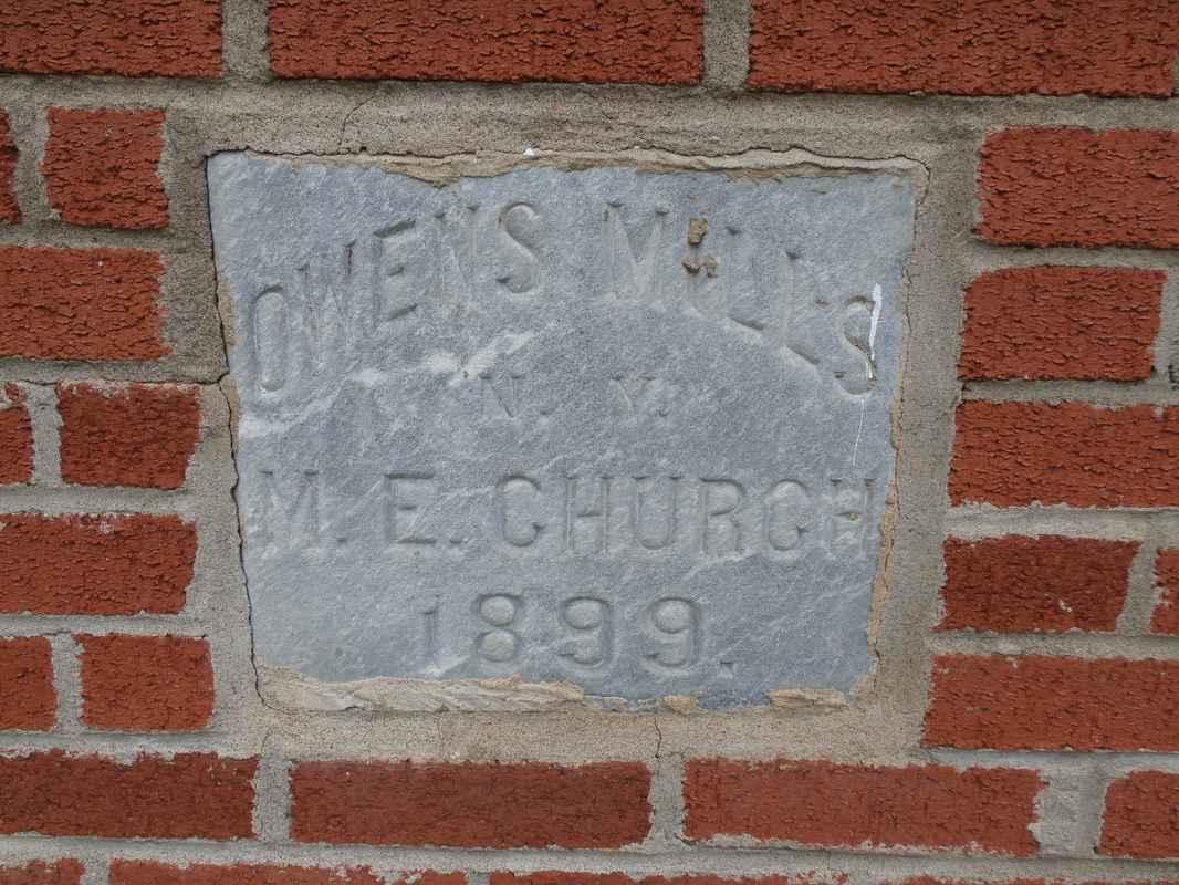
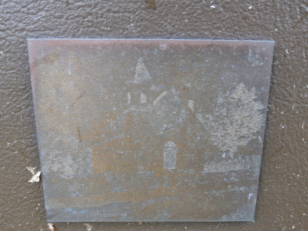
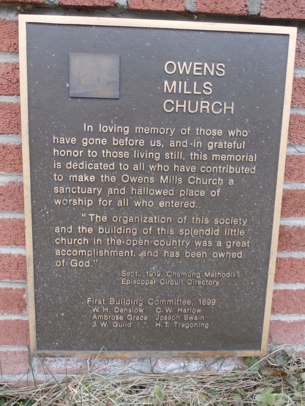
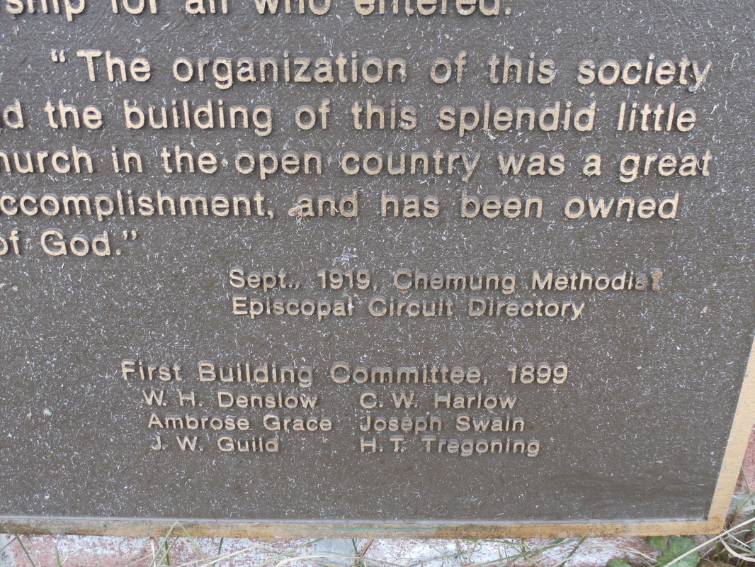
Owens Mills Methodist Church Memorial 1899. Hamlet of Owens Mills, Town of Chemung, New York. GPS#42.068568,-76.597082
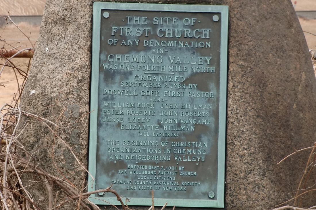
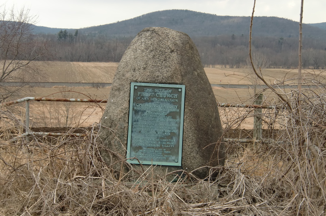
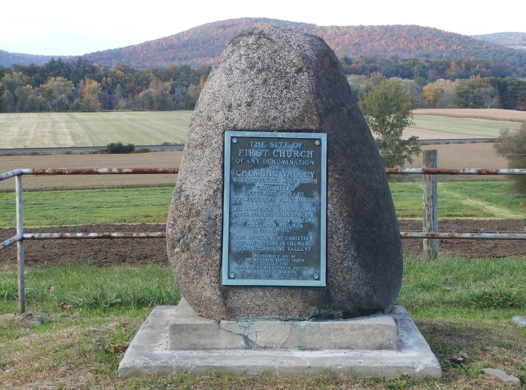
The site of First Church of any Denomination in Chemung Valley, NYS Historic Marker, located on Wilawana Rd, east of the Village of Wellsburg, Chemung, New York GPS#42.015283,-76.701167


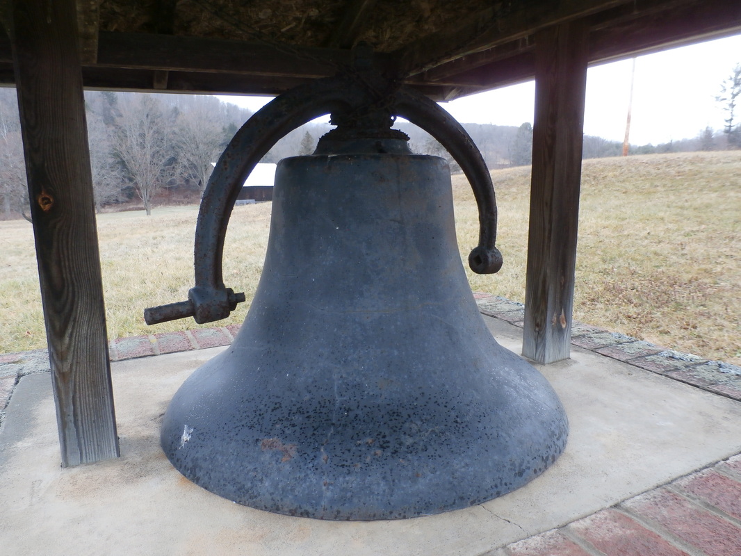
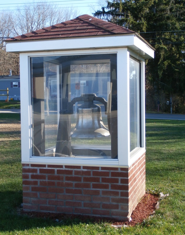
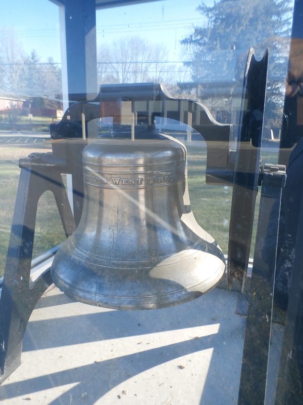
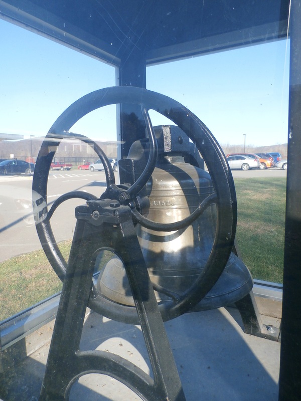
Original School Bell from the Chemung School House #2, made in West Troy, NY 1852. Bell House located at the Chemung Elementary School, North St, Chemung, New York GPS#42.010596,-76.617271
Hamlet of Lowman, Town of Ashland, Chemung County, NY
NYS Historic Markers located in the Hamlet of Lowman, Town of Ashland, Chemung County, NY
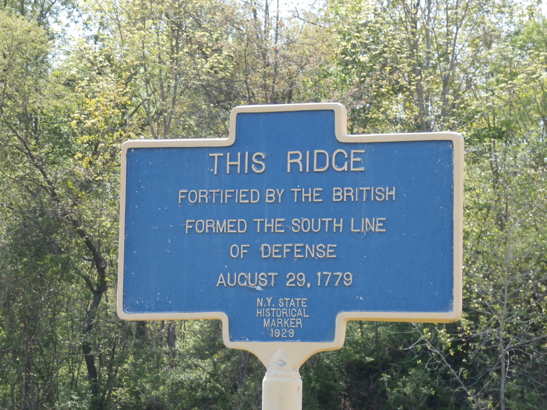
This Ridge, Fortified by the British 1779, NYS Historic Marker, Hamlet of Lowman, Town of Ashland, Chemung County, NY GPS42.027174,-76.721647
|
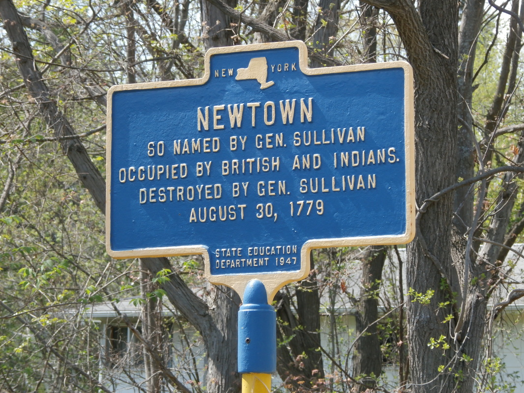
Newtown, named by General Sullivan. 1779. NYS Historic Marker, Hamlet of Lowman, Town of Ashland, Chemung County, NY GPS42.051018,-76.747206 (Located near the entrance to Newtown Battlefield Reservation State Park, Newtown was an Indian Village, now known as Elmira. The marker is in the wrong location.)
|
This Ridge, Fortified by the British 1779, NYS Historic Marker, Hamlet of Lowman, Town of Ashland, Chemung County, NY GPS# 42.027174,-76.721647
Newtown, named by General Sullivan. 1779. NYS Historic Marker, Hamlet of Lowman, Town of Ashland, Chemung County, NY GPS#42.051018,-76.747206
(Located near the entrance to Newtown Battlefield Reservation State Park, Newtown was an Indian Village, now known as Elmira. The marker is in the wrong location.)
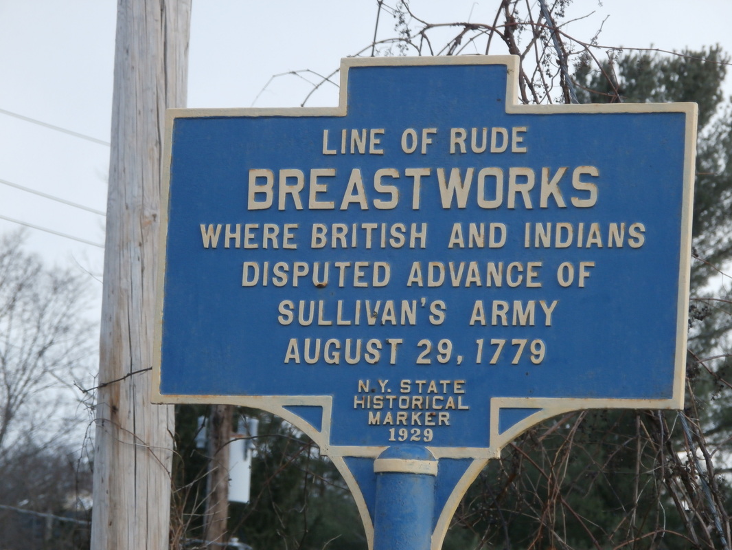
Line of Rude Breastworks, NYS Historic Marker, located on County Route 60 Hamlet of Lowman, Town of Ashland. GPS# 42.029926,-76.720415

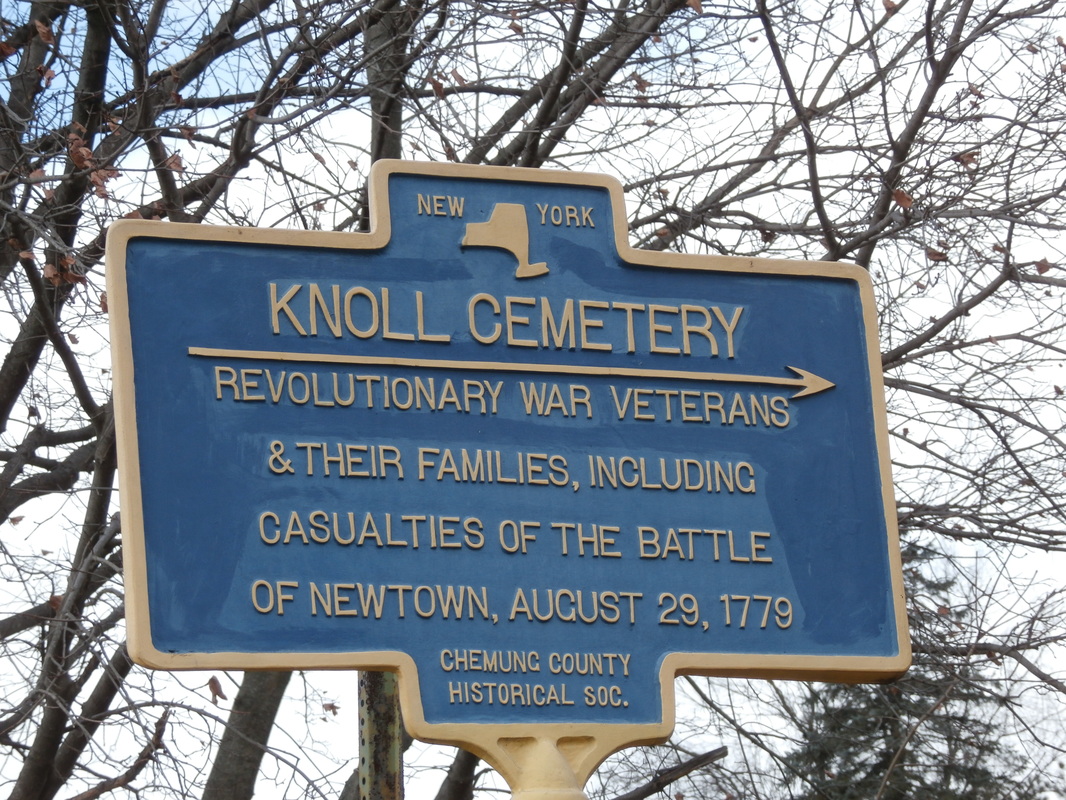
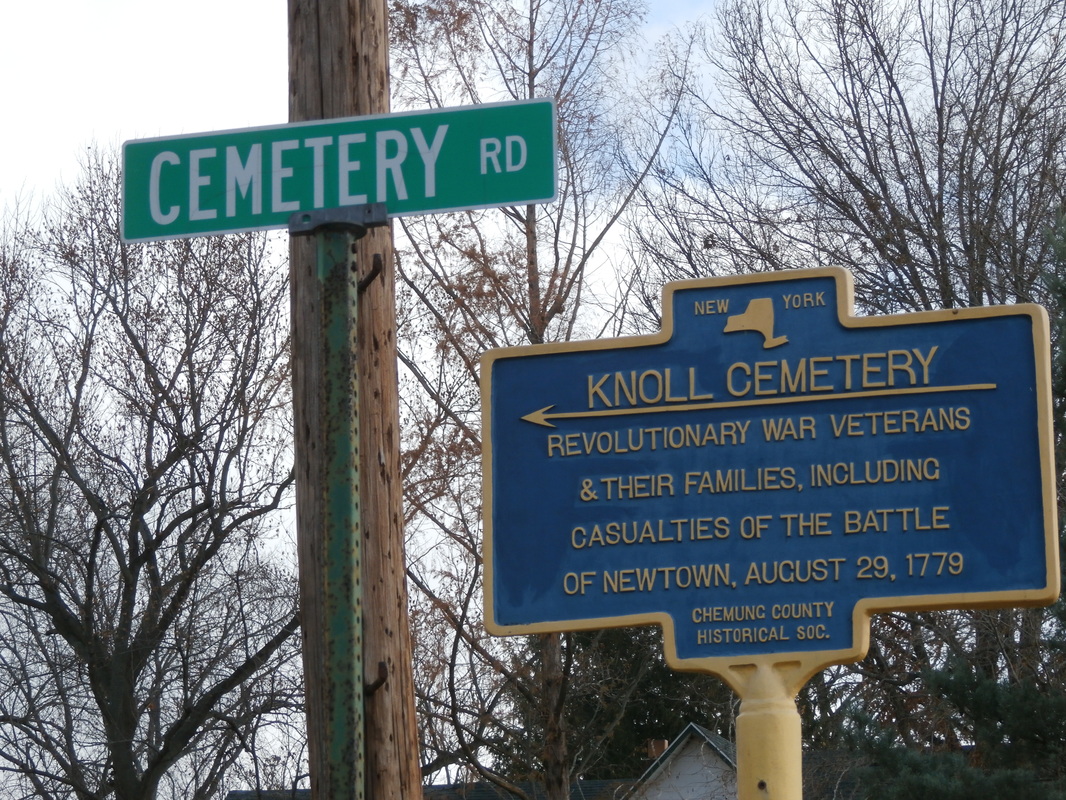
Knoll Cemetery, NYS Historic Marker, located on County Route 60, in the Hamlet of Lowman, Town of Ashland, NY GPS# 42.031163,-76.724153
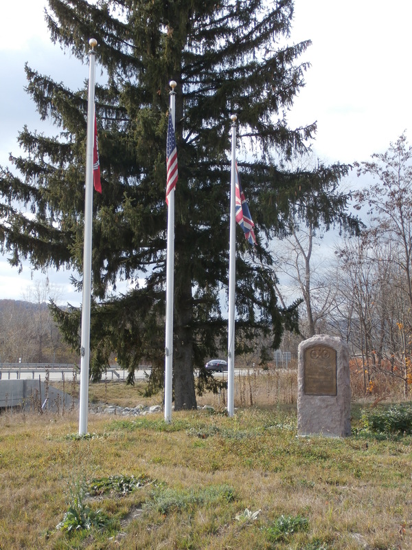
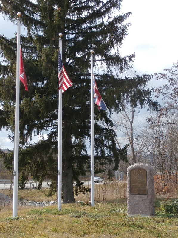
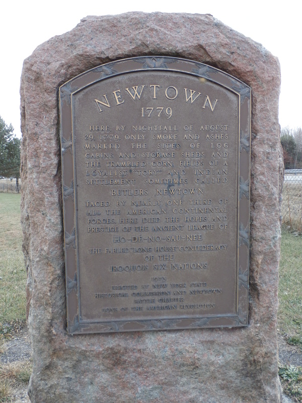
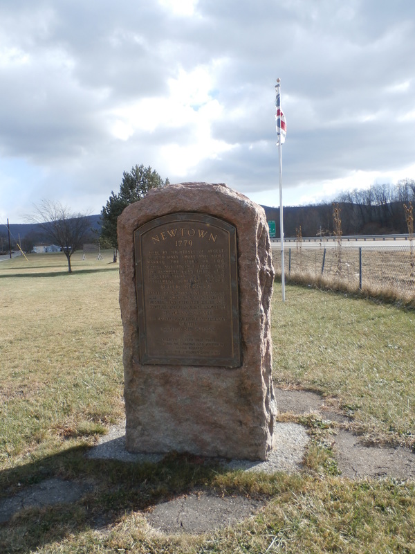
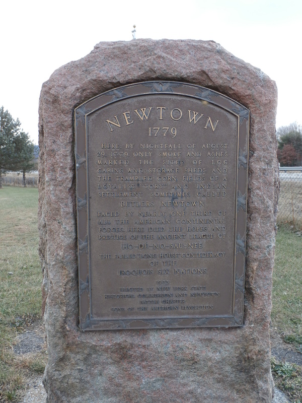
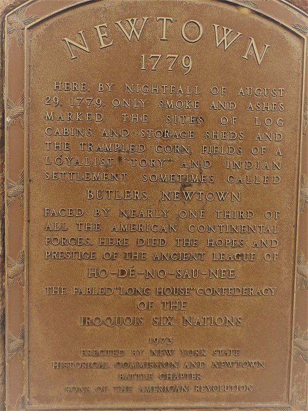
NEWTOWN 1779 (Butlers Newtown), NYS Historic Marker, Located on County Route 60 in the hamlet of Lowman, Town of Ashland, NY. Interstate 86 can be seen in the background of the photos. The Union Jack Flag flies alone at this site. GPS# 42.032997,-76.728286
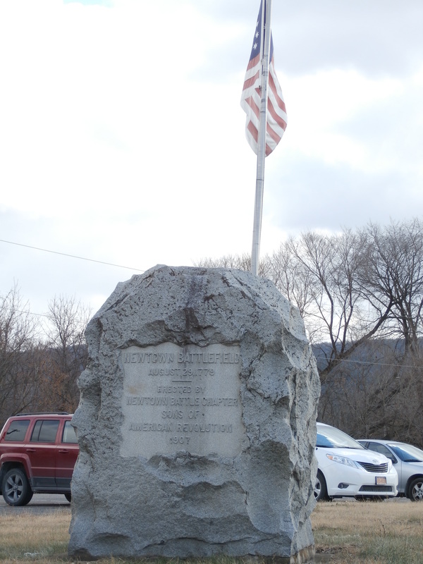
Newtown Battlefield 1779, NYS Historic Marker, Located on County Route 60 in the hamlet of Lowman, Town of Ashland, NY, situated in the park & ride lot adjacent to Interstate 86 and the Lowman/Wellsburg overpass. The American Flag flies alone at this site. GPS#42.029902,-76.720810

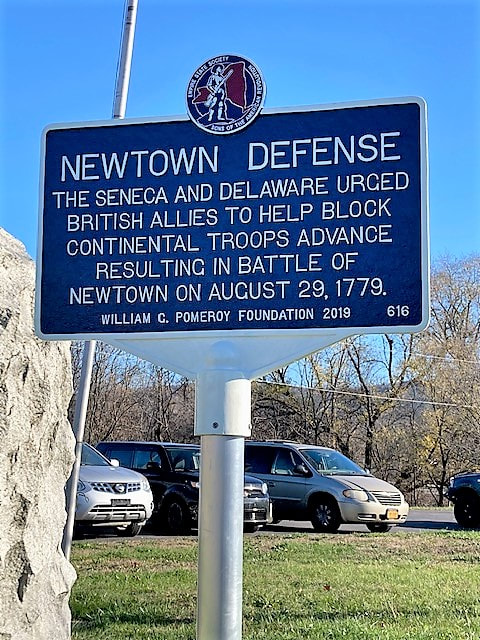
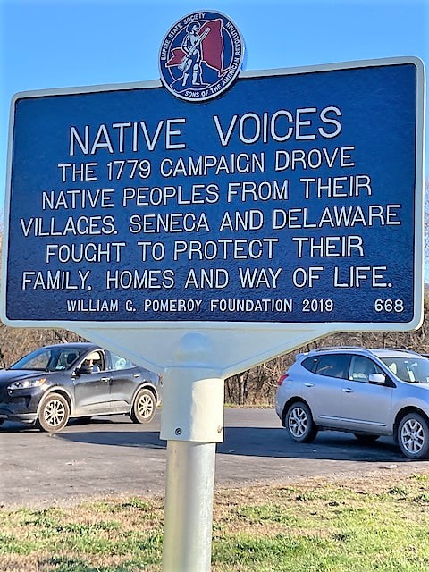
Newtown Defense and Native Voices located in Lowman, NY 42.030319, -76.719879
|
|
Waverly, Tioga County, New York
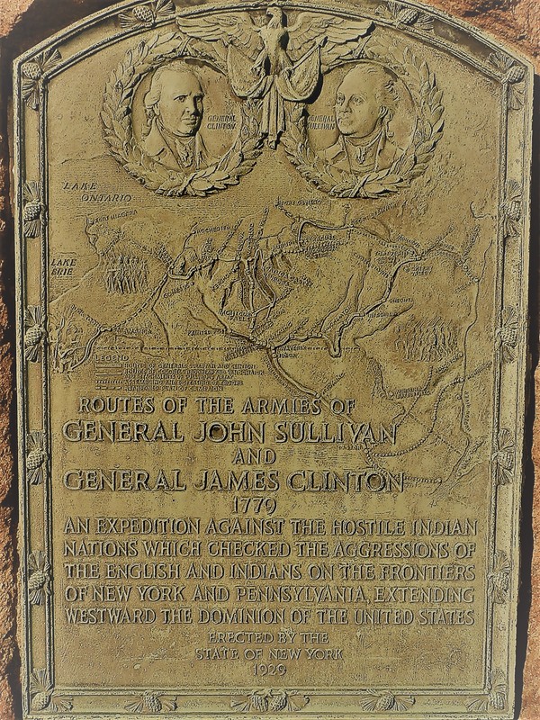
Routes of the Armies of General John Sullivan and General James Clinton 1779. NYS Historic Marker, located on County Rt. 60, (Waverly Hill), west of town, Waverly, NY GPS#42.003931,-76.554430