Price (#2) Burial Plot
June 1935 Listing of Chemung Cemeteries, inventoried by C.W. Northrup rediscovered by Linda P. Doane at the Tioga Point Museum February 2017
The pdf file is the entire booklet, I was unable to separate the cemeteries.
The pdf file is the entire booklet, I was unable to separate the cemeteries.
| chemung_cemeteries_1935.pdf |
GPS# 42.097036,-76.588132
Price #2/Simcoe Cemetery On County Rd 23 (Mallory Rd) about a mile south of Put (Putnam) Hill Rd, and 3/10th’s of a mile north of the intersection of Mallory and Miller Hollow Roads, on the east side of the road, fenced in a field, Town of Chemung. (Family Cemetery over 10 burials. Deserted-No apparent cemetery group. Earliest burial 1890’s, latest burials 1900’s).
For a listing of graves, please view: http://www.joycetice.com/cemc/price2.htm
For a listing of graves, please view: http://www.joycetice.com/cemc/price2.htm
September 4, 2016
Ron and I were out for a ride to look for the Price #1 Burial Plot on Put (Putnam) Hill Road, following the 1869 Town of Chemung map. We soon realized the road changed a little bit since that map was drawn out! The old district #7 School House is no longer there and the road where the old Price #1 burial plot is gone as well. It's possible to follow the old road by looking at the tree line up in the field, but we did not attempt to locate the plot. After talking with several residents whom we found busy at work on a beautiful day, they pointed us in the direction of the Price #2 plot. (They have never seen the Price #1 plot.)
Following directions and headed down Mallory Road we found several residents who live on the property where the old burial ground #2 is located and were graciously escorted up the farm field to see it.
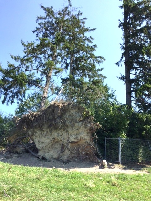
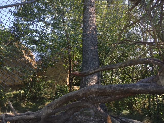
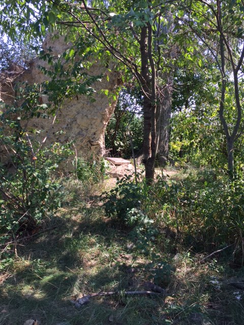
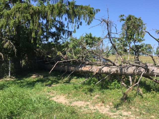
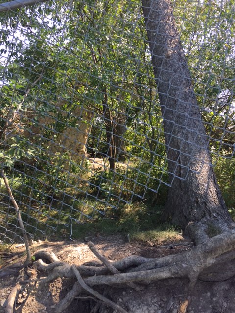
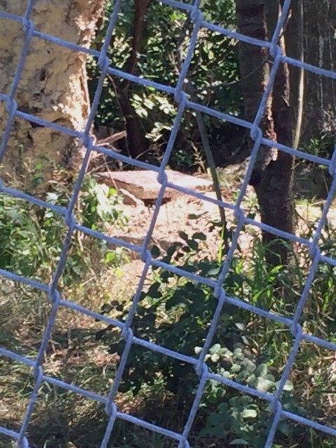
The old burial plot has a modern chain link fence surrounding it with a gate and there were several monstrous pine trees growing in the small area. We also learned of several recent burials in the last two decades, descendants of the family who were buried there.
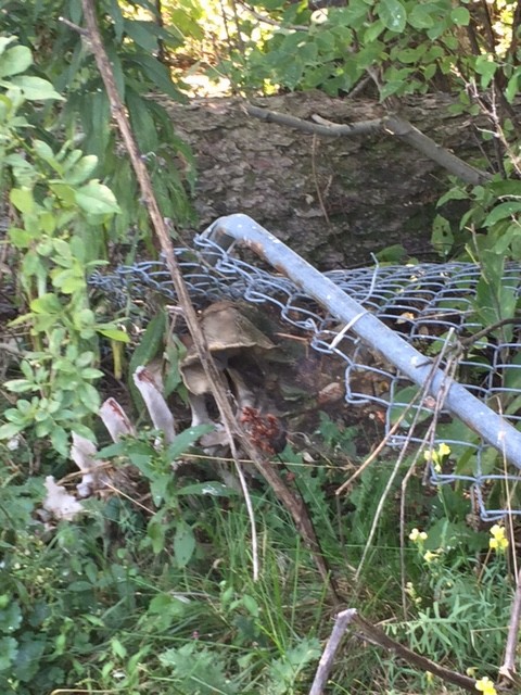
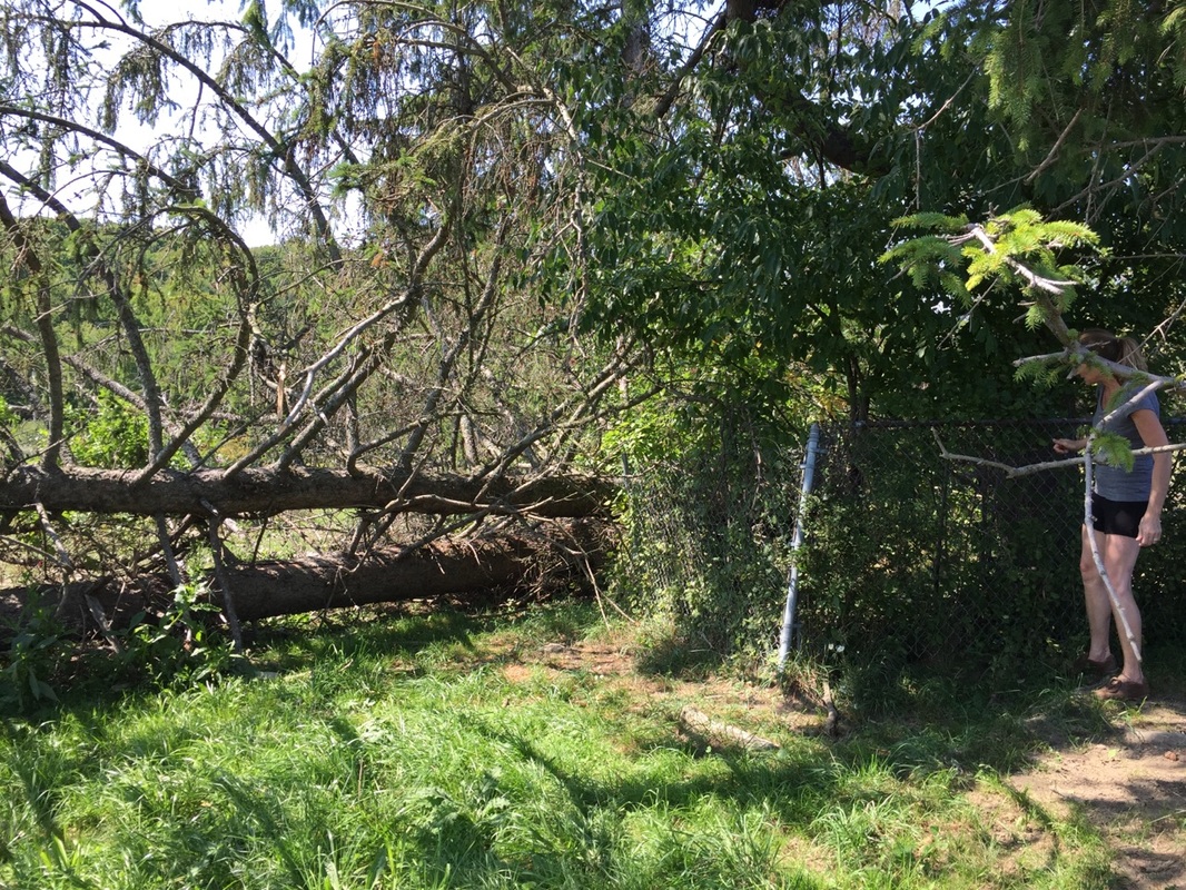
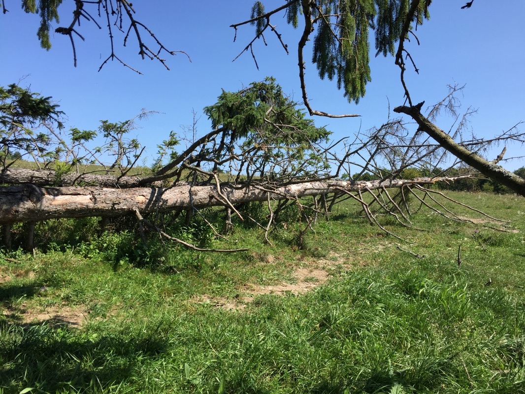
Several years ago during a bad storm and most likely a straight line wind uprooted a number of the old pines. In doing so it instantly killed a couple of cows who were seeking shelter at the base of the trees. Their remains lie trapped under the large tree trunks.
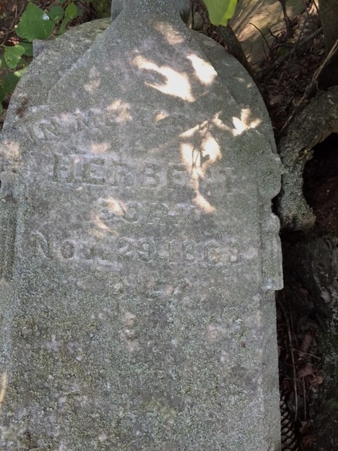
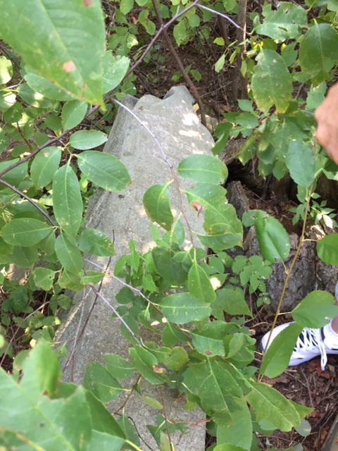
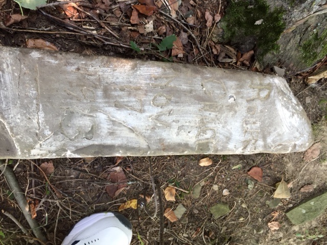
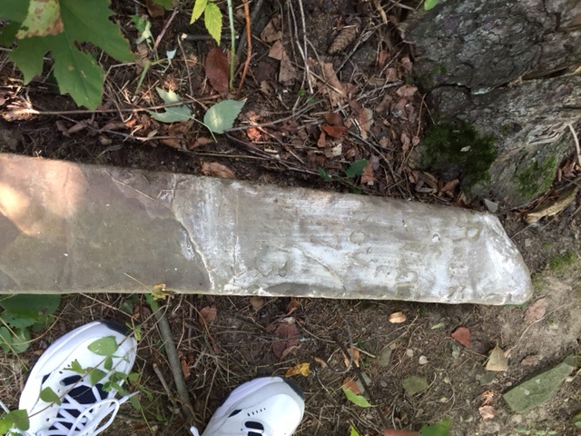
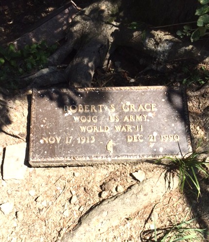
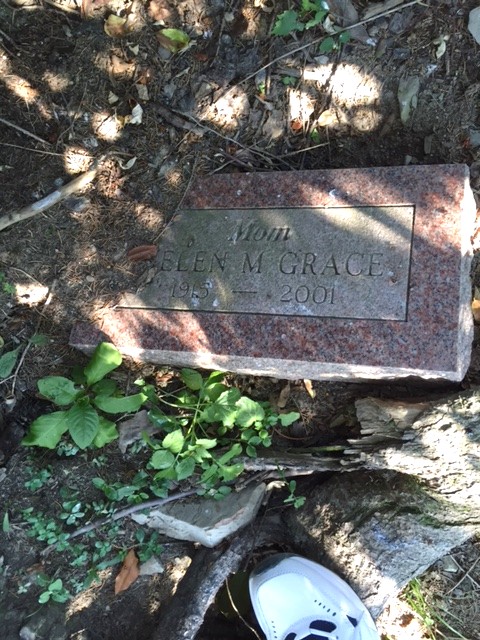
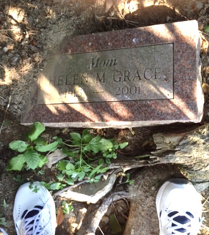
The uprooted trees heavily damaged the cemetery. Very few markers can be located and those we did find had fallen over. The family we spoke with would like to have a work bee sometime in the future to remove the trees. The fence is very damaged, it's near impossible to enter the area. Perhaps once the downed trees are removed more markers will be located.
Below are the images we took today. Mary Ellen Kunst
Ron and I were out for a ride to look for the Price #1 Burial Plot on Put (Putnam) Hill Road, following the 1869 Town of Chemung map. We soon realized the road changed a little bit since that map was drawn out! The old district #7 School House is no longer there and the road where the old Price #1 burial plot is gone as well. It's possible to follow the old road by looking at the tree line up in the field, but we did not attempt to locate the plot. After talking with several residents whom we found busy at work on a beautiful day, they pointed us in the direction of the Price #2 plot. (They have never seen the Price #1 plot.)
Following directions and headed down Mallory Road we found several residents who live on the property where the old burial ground #2 is located and were graciously escorted up the farm field to see it.
The old burial plot has a modern chain link fence surrounding it with a gate and there were several monstrous pine trees growing in the small area. We also learned of several recent burials in the last two decades, descendants of the family who were buried there.
Several years ago during a bad storm and most likely a straight line wind uprooted a number of the old pines. In doing so it instantly killed a couple of cows who were seeking shelter at the base of the trees. Their remains lie trapped under the large tree trunks.
The uprooted trees heavily damaged the cemetery. Very few markers can be located and those we did find had fallen over. The family we spoke with would like to have a work bee sometime in the future to remove the trees. The fence is very damaged, it's near impossible to enter the area. Perhaps once the downed trees are removed more markers will be located.
Below are the images we took today. Mary Ellen Kunst
The 1869 Town of Chemung Map, edited to show the location of the two Price Burial Plots.