Mass Grave Where British & Indians Fell, 1779 Battle of Newtown, Towns of Chemung & Ashland, New York
|
|
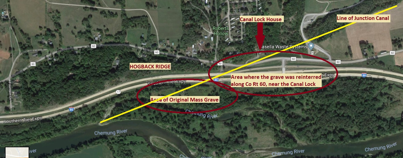
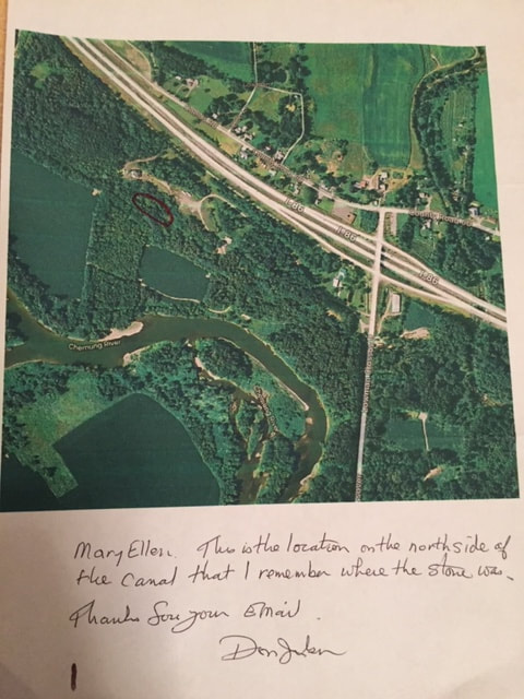
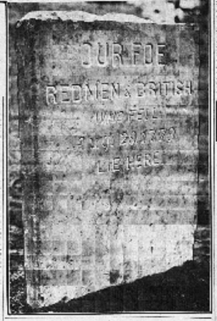
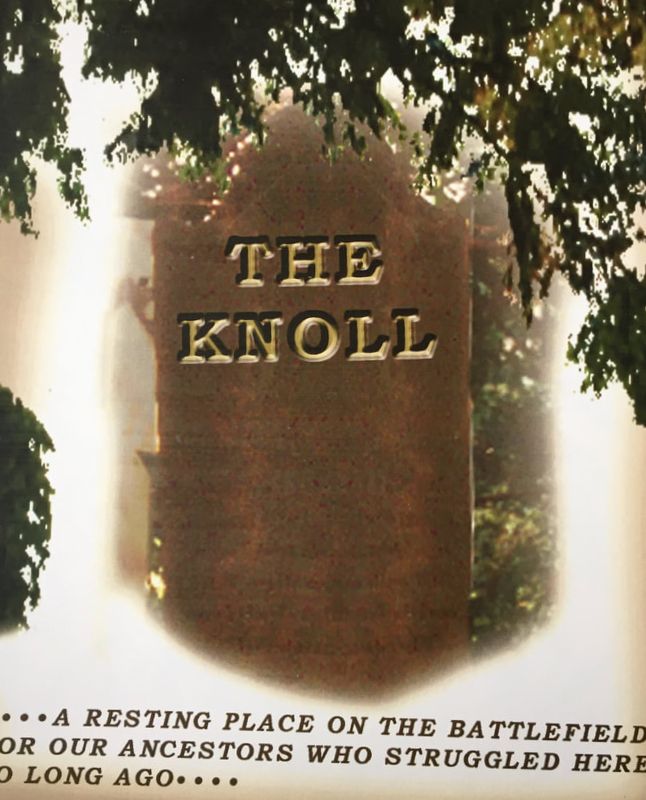
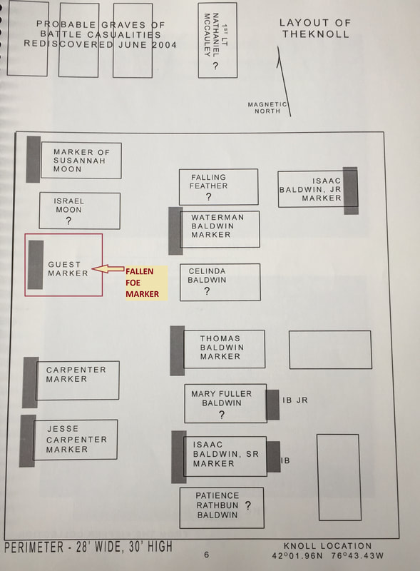
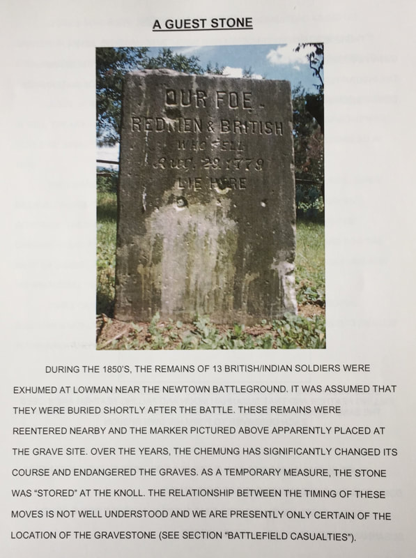
I came across these old clippings last year and have not uncovered anymore information regarding this mass grave. It seems no-one knows exactly where it's original location was and the bodies were moved, according to one of the articles to another unknown location. The location could be in Chemung or Lowman, Town of Ashland, depending on interpretation of the description. From what I can ascertain from the articles, the mass grave originated near the north bank of the Chemung River and to the southside of a hogback. The grave was uncovered when the Junction Canal was being dug and built and the bodies were moved to a new location, according to one article, near the Canal Lock, in Chemung, NY along the old route 17, which is now County Route 60, near Roberts Hollow Rd. My reasoning is because of the Canal Lock that was mentioned. There was no Canal Lock in Lowman that has been recorded, the Canal Lock is located in Chemung. Another article claims the bodies were moved to Lowman, Town of Ashland to the Jilson property. The Marker that was erected in memory of the deceased in 1936, ended up at the Knoll Cemetery in 1966 after a public disagreement with several organizations. I've attempted to contact several people by phone, to no avail and the researcher at the Chemung County Historical Society and the County Historian are unaware of the old graves. It has all been a mystery. The ground where the deceased are buried is hallowed ground and I hope someday to learn the location so it can be marked appropriately for future generations.
|
|
The newspaper clippings I found last year were barely readable. I located the articles on Newspapers.com. I was able to save the articles but only to pdf files which may be due to my inept computer skills at times! So, that is why you will see a compilation of pdf files below. You will have to open each one as you go.
|
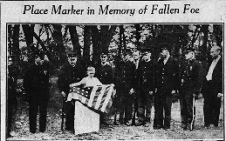
"Place Marker in Memory of Fallen Foe", Star Gazette, Elmira, NY, August 31, 1936 (Photos and story)
| ||
|
"Mark Spot Where British & Indians Fell in 1779", Star Gazette, Elmira, NY, August 31, 1936 (Story)
| ||
|
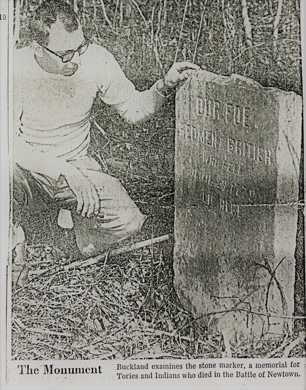
"Dump May Engulf SUV Marker" Star Gazette, Elmira, NY, March 29, 1962 (Photos and story)
| ||
|
"Dump Engulfs Historical Marker" Elmira Advertiser, Elmira, NY, March 31, 1962
| ||
|
"Revolution Marker Victim of Neglect", Star Gazette, Elmira, NY, December 4, 1966
| ||
|
"Historians Join Headstone Battle", Star Gazette, Elmira, NY, December 13, 1966
| ||
Based on what I read in the articles I have come to the conclusion, this is the vicinity where the original grave site was and where the new site is now. Unless the grave is not located in Chemung near the canal and lock and is located in Lowman, which is another possibility. In this map, Lowman is to the left and Chemung is to the right, following County Route 60.